
Living in a flood-prone area, you should know what flood risk determination is. This service helps identify the risks of flooding and the steps you need to take to reduce them. You should also receive advice on what to do before a flood. In this article, we will cover the basics of flood risk determination.
Then, we will discuss how floods impact transportation systems and the costs of flood risk assessments. You can also learn more through the Flood Risk Determination California.
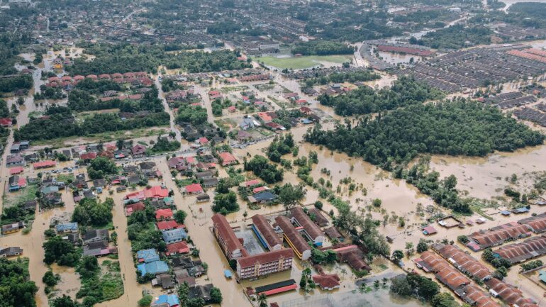
Assessing flood risk
The assessment of flood risks begins by determining the hazard posed by flooding. Then, flood hazard information is overlaid with socio-economic data. This information can be in the form of land-use data, building datasets, population, and regional GDP. The resulting flood risk curve can be used to develop post-event response plans and mitigation measures. But how can the results be used to make the best decisions possible?
The most common hazard conditions are depth, duration, and velocity of moving water. In urban riverine settings, the most critical flood condition is the annual maximum depth of inundation, which is the difference between the lowest floor elevation and the highest water surface elevation.
Damage is typically highest when the entire floor elevation exceeds the water surface elevation, so the hazard assessment model considers all of these factors. In addition, different models may sometimes use other methods to estimate risk based on site-specific conditions.
The National Flood Insurance Program uses the hazard assessment methodology to determine flood risk for insurance purposes. This method relies on the hydrologic approach developed in the 1960s. First, it estimates flood risk based on the probability that a given area will experience a flood. Then, it calculates the average annual loss based on the hazard-exceedance probability function. This approach is summarized in the NFIP insurance rate.
Impacts of flooding on transportation systems
Flooding has many consequences on transportation systems, ranging from structural failure and reduced travel speeds to a decrease in connectivity. The impact of flooding is compound, and if urban flooding coincides with increased population, it could result in catastrophic consequences.
Therefore, long-term transportation development plans must consider the potential for multiple failures of road transportation systems. This study demonstrates the value of incorporating the risks associated with flooding into transportation development plans.
Transport systems are vital to the efficient movement of people and goods. However, in extreme weather, disruption of the transportation system can disrupt normal operations and cause significant economic and social effects.
Flooding is a primary cause of weather-related disorders in the transport sector. Yet, most existing approaches fail to account for the interplay between the floodwater and transportation systems. They often assume that the road has been blocked by floodwater, even though the depth of the water and vehicle speed are correlated.
Flooding also reduces economic productivity. For example, during the 2011 and 2013 floods in Boulder, Colorado, flood waters closed down 485 miles of state-maintained roadways and caused more than 1,100 landslides, resulting in the closure of numerous rural towns for weeks.
Overall, the costs of these floods were about $230 million, and the impacts on transportation systems are significant. In addition, flooding causes delays and economic disruption to communities and can even affect the flow of people between cities and the rest of the country.
Cost of assessing flood risk
The cost of assessing flood risk for a property varies depending on the type of assessment and the scale of the threat. A preliminary evaluation, also known as a Flood Screening Study, involves a desk study of the site, analyzing all the data available from the Local Planning Authority and the Environment Agency. It can also include information from other flood risk assessments to confirm the data. The more detailed the examination, the more expensive it can be.
The damage factor is the relationship between hazard and vulnerability. This factor defines the percentage of damage each element faces. The same workflow applies to social risk calculations. Among other things, population data must be provided as input to the social risk calculation based on a flood hazard map.
The mortality factor b is the proportion of casualties per flood depth. Once these data are obtained, they are combined with the flood hazard map to arrive at a value for the casualty rate.
Flood hazard assessment is crucial for the successful development of a property. This process is based on the available flood hazard information, and additional information is necessary if the situation warrants it.
The cost of flood risk assessment depends on the assessment type undertaken and the site’s complexity. Nonetheless, the cost of flood hazard assessment and any associated mitigation projects is worth considering. This way, you can avoid wasting money on an insufficiently-defined flood risk assessment.